EmComm & AUXCOMM
Understand communications support, incident coordination and the role of the auxiliary communicator.
Explore resourcesLOCAL KNOWLEDGE. SHARED READINESS.
Amateur radio. Practical preparation. A stronger Arkansas. Your starting point for emergency communications, training and trusted resources.
DRIVEN ELEMENTS AMATEUR RADIO GROUP · NORTHEAST ARKANSAS ROOTS
FIND YOUR STARTING POINT
Understand communications support, incident coordination and the role of the auxiliary communicator.
Explore resourcesKnow the difference between government-directed RACES and ARRL’s ARES program.
Explore resourcesLearn how CISA’s SHARES program supports national security and emergency preparedness with high-frequency radio. Participation requires program authorization.
Explore SHARESFind NWS training and reporting guidance for your area. Start with your responsible forecast office.
Explore resourcesExplore digital voice, data and the difference between local RF and internet-linked paths.
Learn about D-STAR ↗Learn about chat, forms and small-file transfers using D-STAR’s low-speed data channel.
Learn about D-RATS ↗FROM INTEREST TO READINESS
Effective support starts with trained people, clear messages and a shared plan. Work through the basics, then practice with the organization you intend to support.
Follow the training pathway →Start with ICS and NIMS fundamentals.
Practice message handling, logging and station setup.
Confirm requirements, assignments and activation procedures.
ROOTED IN NORTHEAST ARKANSAS
DEARG’s earlier web presence reflects a community interested in VHF operating and amateur radio service. Explore the photographs and Field Day clipping preserved from the existing site.
Explore Over the Years →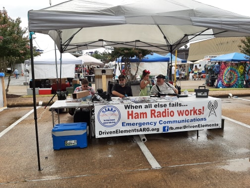 FROM THE DEARG ARCHIVE / DATE UNCONFIRMED
LOOK TO THE SOURCE
Check the local weather panel below for the latest retrieved NWS information, or open the official forecast.
LOCAL WEATHER / 72476
NWS conditions, forecasts, and watches, warnings & advisories for the surrounding area.
—
An internet connection and JavaScript are required for updates.
No observation loaded.Open the official forecast below for current information.
No forecast loaded.Alert status unknown until the NWS feed loads.
72476 uses the NWS Walnut Ridge forecast point (36.0698, −90.9583). Alerts include Lawrence County and its forecast zone, so an alert may cover areas beyond this ZIP code; read its affected area and instructions. Updates check every 5 minutes while this page is visible. This webpage does not send push notifications and does not replace Wireless Emergency Alerts or NOAA Weather Radio.
BEYOND THE HORIZON / RADIO CONDITIONS
Solar-terrestrial data and propagation estimates from HamQSL, alongside a calculated view of the Moon.
Check the date and time printed within the panel. If the image does not load, view the data at HamQSL.
Solar data panel courtesy of Paul Herrman, N0NBH / HamQSL. All embedded credits are retained.Calculation requires JavaScript.
Approximate geocentric illumination, calculated on your device.
SunCalc · uses your device clockThe panel loads directly from HamQSL when you view this section; its availability, updates and timestamps are controlled by that provider. Propagation estimates do not guarantee conditions at your location. This is an independent amateur-radio resource, not an official alert feed. Moon phase is calculated on your device and is approximate.